


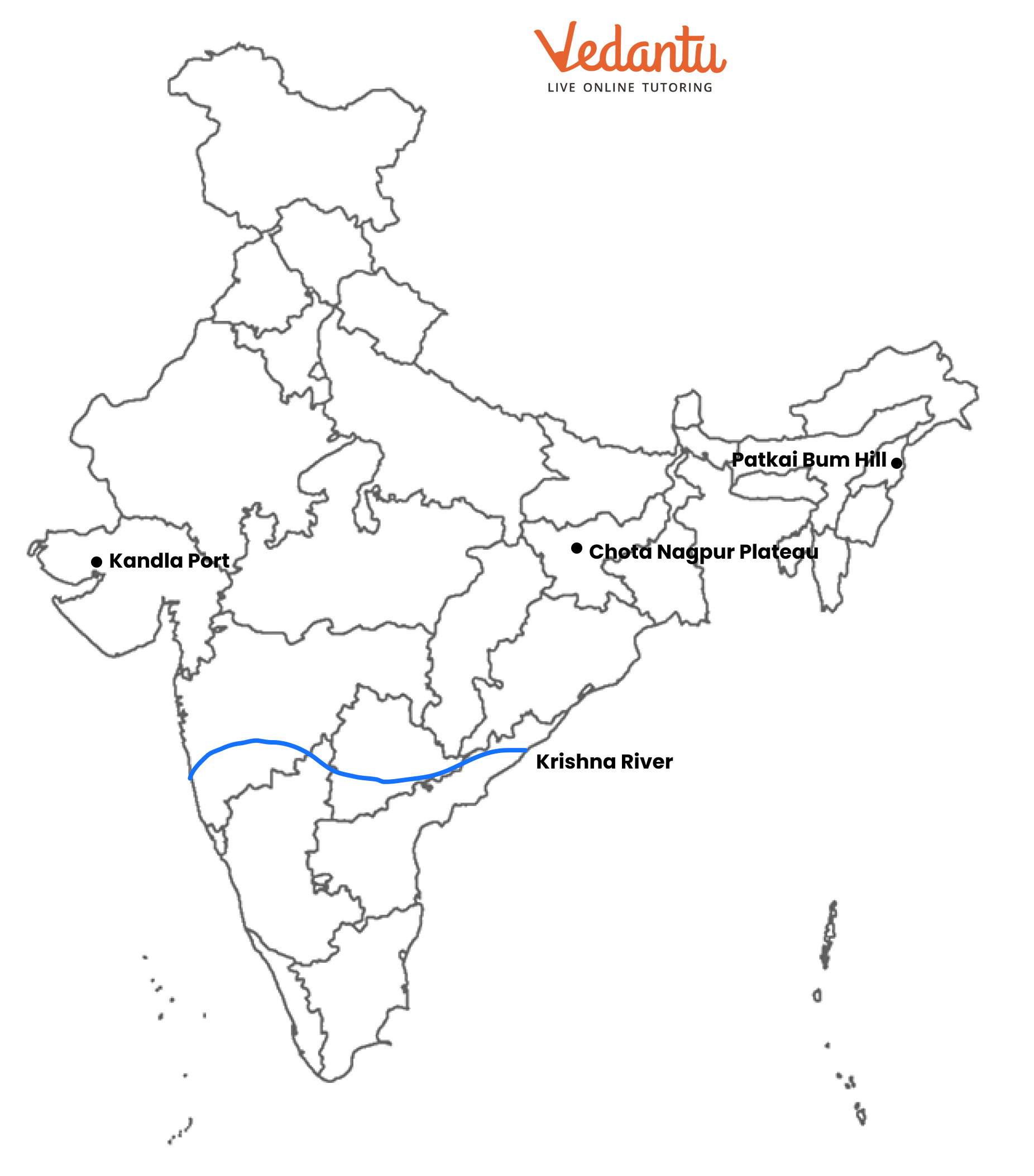
Mark and label the given geo-information on the outline map of India provided. River Krishna, Chotanagpur plateau. Kandla port, Patkai Bum hills
Answer
519k+ views
Hint: The aim of labelling a map is to connect the information you hear when listening to the gaps in the map. In some maps, you are given a list of terms and must choose the one that best fits the map.
Complete answer:
After the Ganga, Godavari, and Brahmaputra, the Krishna River is India's fourth-largest river in terms of water inflows and river basin size. The river stretches for nearly 1,288 kilometres. The river is also known as the Krishnaveni.
The Chota Nagpur Plateau is a plateau in eastern India that encompasses most of the state of Jharkhand as well as neighbouring areas of Odisha, West Bengal, and Chhattisgarh. To the north and east of the plateau is the Indo-Gangetic plain, and to the south is the Mahanadi river basin.
Kandla is a seaport and town in Gujarat's Kutch District, close to the city of Gandhidham. It is one of the main ports on the west coast of India, located on the Gulf of Kutch.
The Pat-kai, also known as the Patkai Bum (meaning "to cut (pat) chicken (Kai)" in Tai-Ahom, are the hills that run along India's northern border with Burma or Myanmar. They were formed by the same tectonic processes that formed the Himalayas during the Mesozoic period.
Note: Labeling allows you to apply descriptive text to your map for a variety of features. Labeling can be a quick way to add text to your map, and it saves you from having to manually add text for each element.
Recently Updated Pages
Master Class 11 Computer Science: Engaging Questions & Answers for Success
Master Class 11 Business Studies: Engaging Questions & Answers for Success
Master Class 11 Economics: Engaging Questions & Answers for Success
Master Class 11 English: Engaging Questions & Answers for Success
Master Class 11 Maths: Engaging Questions & Answers for Success
Master Class 11 Biology: Engaging Questions & Answers for Success
Trending doubts
One Metric ton is equal to kg A 10000 B 1000 C 100 class 11 physics CBSE
There are 720 permutations of the digits 1 2 3 4 5 class 11 maths CBSE
Discuss the various forms of bacteria class 11 biology CBSE
Draw a diagram of a plant cell and label at least eight class 11 biology CBSE
State the laws of reflection of light
Explain zero factorial class 11 maths CBSE