


How do you know where the most gentle slope is?
Answer
559.5k+ views
Hint: The slope of a land is depicted on the maps and topographical sheets by the distance between the contour lines on the map.
Complete answer:
The slop on a map is determined by the contour interval which is basically the distance between the contour lines on the map. By analysing the contour lines, a fair idea of the slope of the land of the region under analysis can be made. This is a very easy technique to determine if the land is hilly, plateau shaped or a plain area.
If the contour lines are very close enough, it is a representation of a steep slope or a steeply sloped mountain.
If the contour lines are fairly close enough, it is a representation of a normal slope or an average hill.
If the contour lines are far enough, it is a representation of a gentle slope.
So, by looking only at the spacing of the contour lines, one can tell if a slope is gentle, normal or steep. Hence, the most gentle slope is the region on the map where the contour lines are found at the largest distance.
A depiction of the contour interval on the map is given below for the reference of the students.
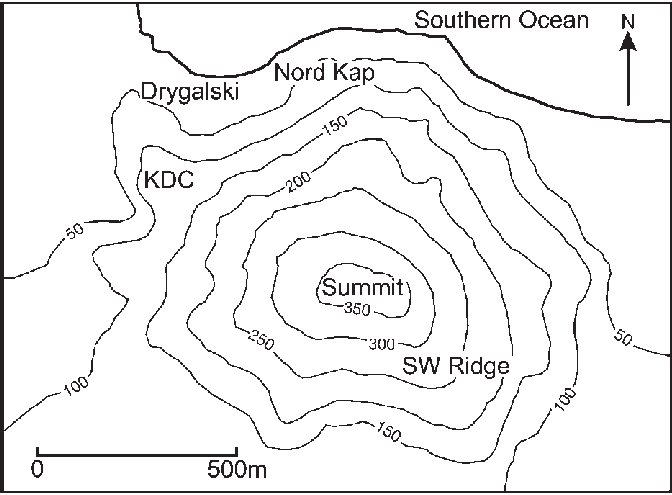
Note: The contours are the line on a map or a topographical sheet which connect the places of the same elevation form the mean sea level on the map. They are the most important tools for survey purposes and a geographer relies the most on the contouring methods.
Complete answer:
The slop on a map is determined by the contour interval which is basically the distance between the contour lines on the map. By analysing the contour lines, a fair idea of the slope of the land of the region under analysis can be made. This is a very easy technique to determine if the land is hilly, plateau shaped or a plain area.
If the contour lines are very close enough, it is a representation of a steep slope or a steeply sloped mountain.
If the contour lines are fairly close enough, it is a representation of a normal slope or an average hill.
If the contour lines are far enough, it is a representation of a gentle slope.
So, by looking only at the spacing of the contour lines, one can tell if a slope is gentle, normal or steep. Hence, the most gentle slope is the region on the map where the contour lines are found at the largest distance.
A depiction of the contour interval on the map is given below for the reference of the students.
Note: The contours are the line on a map or a topographical sheet which connect the places of the same elevation form the mean sea level on the map. They are the most important tools for survey purposes and a geographer relies the most on the contouring methods.
Recently Updated Pages
Master Class 9 General Knowledge: Engaging Questions & Answers for Success
Master Class 9 Social Science: Engaging Questions & Answers for Success
Master Class 9 English: Engaging Questions & Answers for Success
Master Class 9 Maths: Engaging Questions & Answers for Success
Master Class 9 Science: Engaging Questions & Answers for Success
Class 9 Question and Answer - Your Ultimate Solutions Guide
Trending doubts
Difference Between Plant Cell and Animal Cell
Fill the blanks with the suitable prepositions 1 The class 9 english CBSE
Who is eligible for RTE class 9 social science CBSE
Which places in India experience sunrise first and class 9 social science CBSE
What is pollution? How many types of pollution? Define it
Name 10 Living and Non living things class 9 biology CBSE